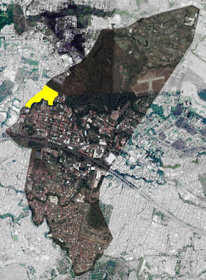
An evaluation of the tree-coverage of an established area was conducted in order to test and learn about tools and methods to achieve a general land cover assessment without it being too expensive for our means.
We selected five categories to classify 100 random GPS locations in the campus of the Universidad Autónoma de Centro América, from now on referred as UACA. Located in the District of Sanchez that belongs to the canton named Curridabat of the San Jose Province in Costa Rica.
As explained before, the UACA campus limits on its south border with the Río María Aguilar Biological Corridor, this river crosses the capital of Costa Rica, San José, the most populated city in the country. Every property that neighbors this or any Biological Corridor or river, should be aware of the importance and impact on the ecosystem that its operations imply, and has a responsibility to improve or at least not interfere with the well being and overall health of the Biological Corridor.
Knowing the percentage of tree coverage is one of many layers of information that will help and guide decision makers while planning future buildings and landscaping, and help with the management of the urban forest, taking the local flora and fauna into consideration.
i-Tree Canopy is a free software developed by the USDA Forest Service to quickly produce a statistically valid estimate of land cover types using aerial images available in Google Maps. To try out in a small area and learn about this software before making a 1000 random GPS location assessment at a District level, we started out with 100 random points, which led to a considerable standard error that would otherwise decrease as more points are classified.
More information about i-Tree Canopy can be found here: https://www.itreetools.org/about.php
More information about i-Tree Canopy can be found here: https://www.itreetools.org/about.php
We encountered trees 23 times in this random point assessment. As much as 33% of the area of study is covered by several species of wild or cultivated grass and bare earth. 26% of the surface is covered with impervious surfaces such as roofing, concrete, asphalt or water features such as pools and ponds, we classified it like this so we could compare it to the urbanized but pervious surfaces like pavings composed of cobble or setts which cover an estimated area of around 18%, this also includes the sport fields like Baseball, Volleyball and Soccer fields.
We also wanted lo locate these categories to know where to strategically plant trees, so that the canopy can be interconnected in the future. The outlines were traced with a CAD software and generated an overlay for the Satellite image.
Tree coverage can now be seen with ease, further characterization and analysis of the types of trees, as well as their health should be considered to better manage the landscape in future projects.
If you are interested in conducting these types of assessments where you live let us know, we will be glad to help! Next up will be planting some native trees and watch them grow.


